19th November, 2014
Here's a little ode to Ordnance Survey maps. An essential piece - possibly THE most essential piece - of kit for any self-respecting walker or cyclist. We give all our walking and cycling holiday customers one on the first day or their trips, just as a reference to use alongside their detailed written Route Directions. For those who like to follow their nose and take the occasional detour, the maps are invaluable in helping them relocate onto the designated route. Here at The Carter Company however, our fondness for OS maps goes beyond an appreciation of their functional utility and into pure, unabashed sentimentality. It's not just the sound they make when they crumple neatly (or messily, depending on your dexterity with these things, I've never quite got the hang of it!) back into a handy pocket size, or the subtle yet beautifully selected colour palette of the design... although we very much like these qualities.... it's that they represent a world of uncharted territory, a Famous Five style adventure, a treasure trove of natural wonders just waiting to be discovered. Just looking at one makes us want to jump up, tug on our walking boots and head out into the wild.
We're not the only ones who love them. Last month, the BBC ran a feature entitled Why do people love Ordnance Survey maps?, which is a very interesting read.
Having travelled all over the world, we think they are the best maps on earth. They may seem dry on first encounter, but they are absolutely brilliant. Below we share some of our favourite things about OS maps below:
It's nerdy but we love how they honour the details: delineating between paths and bridleways, showing where locks are on the canals, marking out which side of rivers the towpaths are on
Wendy our Founder and Director has fond/painful memories of O-level geography where she had to calculate the difference in elevation through a cross-section of map using the contour lines. But seriously the contour lines are brilliant - just from a glance you can tell where the terrain is steep!
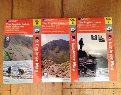
We love the photos they put on the front of each edition. Again, very geeky but we like to play a little game in the office where we have to guess where the photo is taken (Wendy usually gets it right, surprise surprise)
They are almost too detailed (!) and what looks like a little lane is actually a private road (not so good if you're trying to use it as a cycling route hoho)
The maps marks pubs, which we think is a very friendly nod to thirsty walkers or parched cyclists who are in need of some refreshment. We also like it where they mark little springs, disused railways, old Roman roads.... but we're less sure about why they are still marking telephone boxes (although you never know when your phone battery might run out).
If all this talk of maps has got you salivating to set out on an adventure, then what are you waiting for? Head over to our dedicated UK cycling holidays and UK walking holidays pages and book your OS-accompanied trip today.
Posted by: Iona Carter